
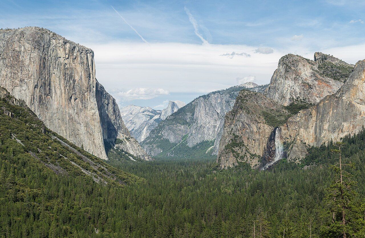
Yosemite Valley is about seven miles long and only around a mile wide, and nearly everything people picture when they hear the name fits inside it: the sheer face of El Capitan, the curved back of Half Dome, the long drop of Yosemite Falls. That compactness is the problem as well as the attraction. On a summer day, a large share of the park's visitors try to drive the same loop road at the same hour, and the valley that looks so open from the viewpoints turns into a slow queue of brake lights.
The good news is that the fix is simple. Come at the right time of year, arrive early, leave the car in one place and move around on the free shuttle, a bicycle or on foot. Do that and the valley gives you exactly what it promises.
When to go
Spring is the season for water. Snowmelt from the high country feeds the falls from roughly April into June, and Yosemite Falls, Bridalveil Fall and Vernal Fall are at their loudest. Meadows are green, the dogwoods flower, and the crowds have not yet reached their summer peak. The trade-off is that some high roads are still closed by snow and nights are cool.
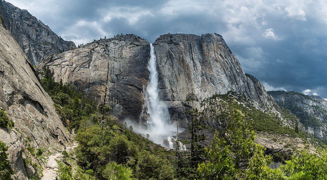
By late summer many of the falls dwindle, and Yosemite Falls can dry to a dark stain on the cliff. Summer brings the heaviest traffic and, in some years, smoke from wildfires elsewhere in the Sierra. September and October are quieter and often clear, though with little water in the falls. Winter is calm and beautiful in the valley, with snow on the rim and the valley floor sometimes white, but some roads and services close and chains may be required on the approach roads.
credit
Diliff · CC BY-SA 3.0Reservations, entry and the roads that close
In recent years the park has used a reservation system for driving in during its busiest months, and the details have changed from year to year: which months it covers, which hours, and whether it runs at all. Having a reservation to sleep in the park or a wilderness permit has usually counted for entry, but do not assume.
Two roads matter for planning. Tioga Road, which crosses the high country to the east side of the Sierra, closes for the winter snow and usually reopens somewhere between late spring and early summer depending on how much snow fell. Glacier Point Road also closes beyond the winter ski area for the snowy months and opens again in late spring. Opening dates vary every year and have been pushed back by heavy winters and roadwork.
All approach roads into the valley are mountain roads with tight curves. Fill your tank before you climb in; fuel inside the park is limited.
The shuttle, the loop and your own feet
The valley floor is served by a free shuttle bus that runs a loop between the main lodging areas, trailheads, the visitor centre and the store areas. In the busy season it is the single best tool you have. Park once, early, in a day-use lot, and leave the car there until evening. The shuttle takes you to the Yosemite Falls trailhead, to the Mist Trail start near Happy Isles and back again, and it avoids the stress of hunting for a space at each stop.
Bicycles are another good option on the flat valley floor, with paved paths separate from the road for long stretches. Walking between nearby stops is often faster than waiting. The valley loop road runs one way in each direction, so a missed turn by car can mean a long circuit; on foot or on a bike it does not matter.
Park once, early, in a day-use lot, and leave the car there until evening.
 Next on the tag · American WestJoshua Tree in the cool months
El Capitan, Half Dome and the falls
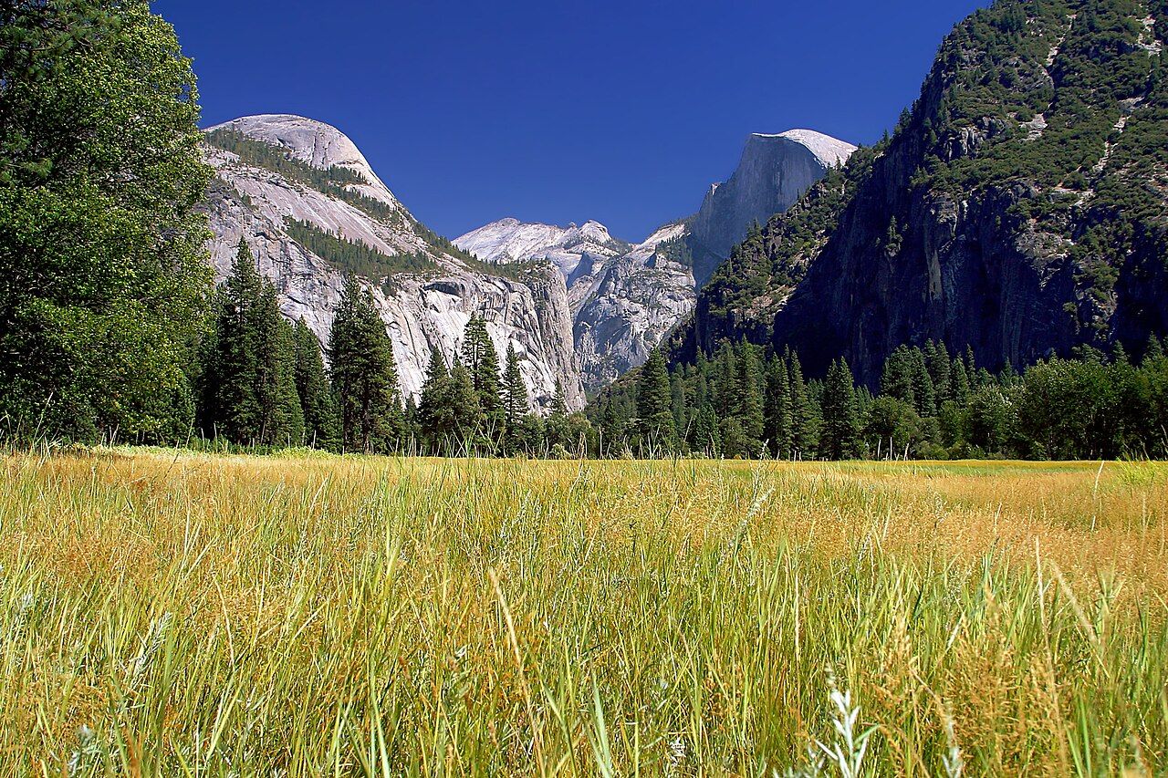
El Capitan is the great granite wall near the western end of the valley. From the meadow at its foot you can often pick out climbers on the face, tiny coloured dots that take days to reach the top. Bring binoculars. The meadows along the Merced River give the best ground-level views and are pleasant for an unhurried hour, though you should keep to paths and boardwalks where they exist.
Half Dome dominates the eastern end. The famous cable route to its summit needs a permit allocated by lottery, and it is a long, strenuous day; the cables are only up in the warmer months. Most visitors see it best from below or from viewpoints. The Mist Trail leads up past Vernal Fall, where in spring the spray soaks you; the granite steps are wet and slippery, so wear shoes with grip and go slowly.
The short loop to the base of Lower Yosemite Fall is flat and suitable for nearly everyone. The trail to the top of Upper Yosemite Fall is a different matter: steep, long and hot in the afternoon, and worth starting early with plenty of water.
credit
Jon Sullivan · Public domain
The views from the edges
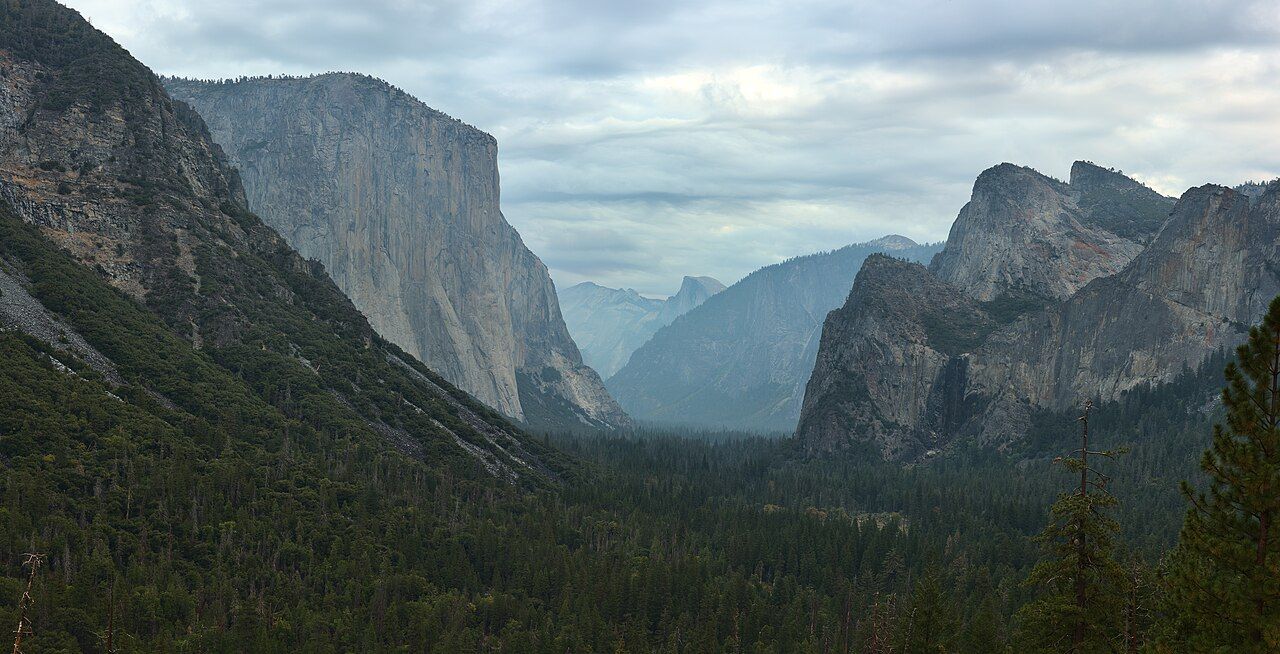
Tunnel View, on the road in from the south just before the tunnel, is the classic first look: El Capitan on the left, Bridalveil Fall on the right, Half Dome framed at the far end. The car park fills, but turnover is quick. Early morning and late afternoon light is softer and the crowds are smaller.
credit
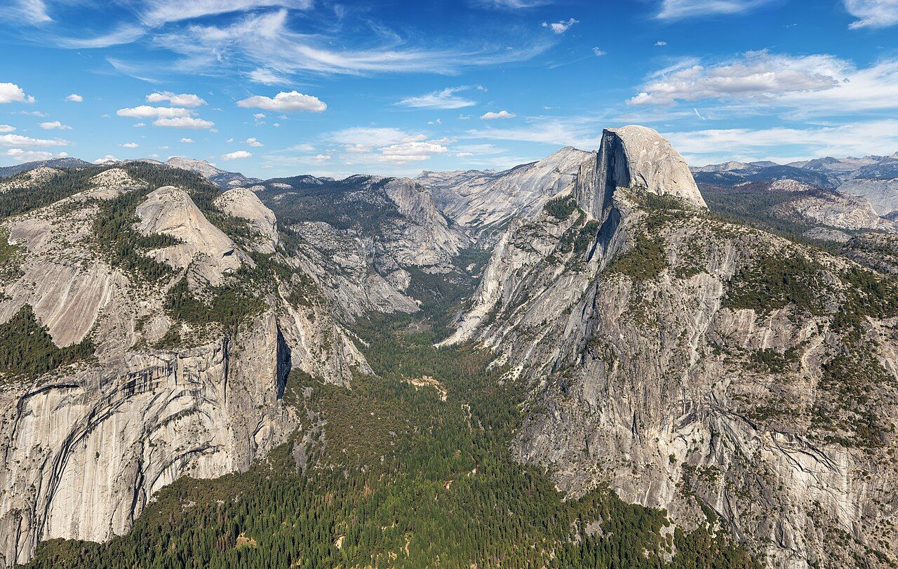
Dllu · CC BY-SA 4.0Glacier Point, when its road is open, looks straight across at Half Dome and down more than three thousand feet into the valley. It is a long drive up from the valley floor, and it is busy around sunset, but the view explains the geology of the whole place in one sweep: the U-shaped valley carved by ice, the domes, the waterfalls dropping from hanging side valleys.
credit
Thomas Wolf · CC BY-SA 3.0Sleeping, eating and bears
Lodging and campsites in the valley book up far ahead, often on the day they open. Towns outside the park gates have more options, at the cost of a longer drive each morning; if you stay outside, check whether your entry arrangements cover that drive. Campgrounds have food lockers, and they are not optional. Black bears in the park have learned that cars and tents hold food, and anything with a scent, from toothpaste to an empty crisp packet, belongs in a locker, not your car.
Food inside the park is functional rather than exciting, and vegetarian choices exist but repeat quickly. Most people do better bringing supplies from the larger towns on the approach roads and picnicking. For broader advice on eating well when choices are thin, see eating vegetarian on the road.
Without a car, regional buses run into the valley from Merced and other gateway towns, and Merced has rail connections. Timetables are seasonal. If a delayed train or bus throws your arrival out, the advice in when you miss the connection applies here too, since the last bus up the canyon is not something you want to miss.