
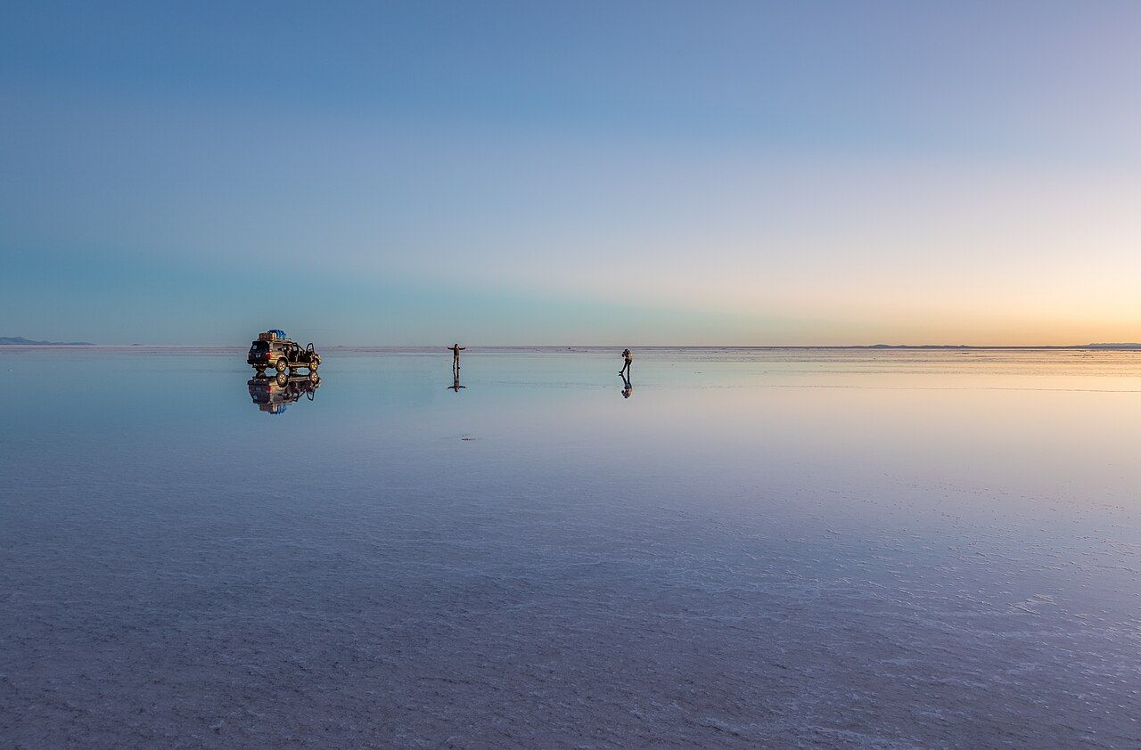
The Salar de Uyuni, in the southwest of Bolivia, is the largest salt flat in the world: more than ten thousand square kilometres of white crust at around 3,650 metres above sea level, left behind by prehistoric lakes that dried out long ago. It is so flat and so bright that it confuses the eye, and in the rainy season a thin sheet of water turns it into a mirror that reflects the whole sky.
Most visitors see it on a tour by four-wheel-drive vehicle from the town of Uyuni, either for a single day or as part of a journey of three days or more south across the altiplano, the high plateau of the Andes, past coloured lagoons, flamingos, geysers and volcanoes. It is a remarkable trip. It is also high, cold and remote, with long hours in a vehicle, and the details of your preparation and your tour make the difference between wonder and misery.
The salt flat itself
Tours usually begin at the edge of Uyuni with the train cemetery, a line of rusting locomotives and wagons left in the desert, and then stop in the village of Colchani, where people dry, grind and pack salt by hand. Out on the flat, workers rake the salt into small conical piles to dry before it is carried away.
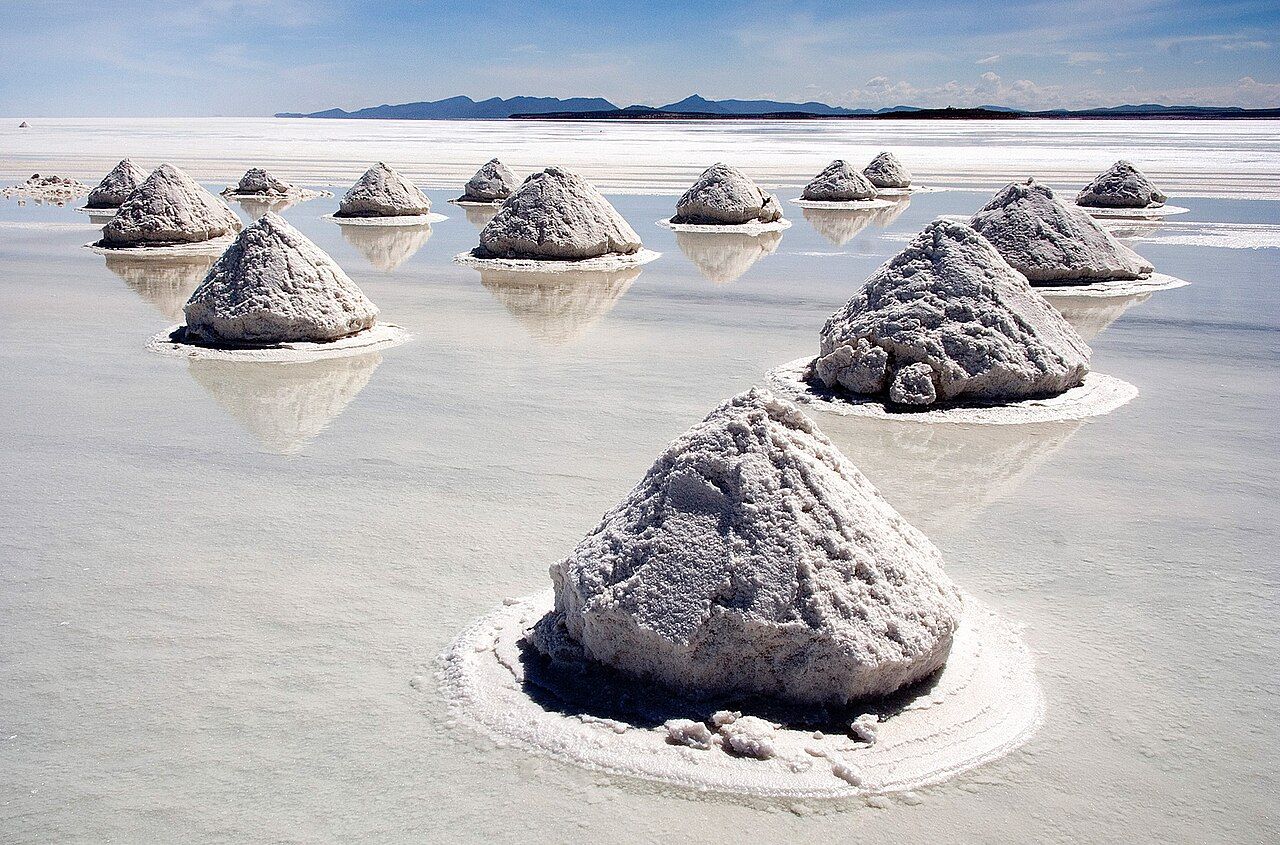
credit
Luca Galuzzi ( Lucag ), edit by Trialsanderrors · CC BY-SA 2.5Further out, the crust stretches to the horizon in every direction. In the dry months it cracks into a pattern of roughly hexagonal ridges, and the total lack of scale makes it the place for playful perspective photographs. In the middle of the flat, Isla Incahuasi is a rocky hill covered in giant columnar cacti, some of them many metres tall, with paths to the top for views across the white plain. Access to the island and its trails is by ticket, and it may be out of reach when the flat is flooded.
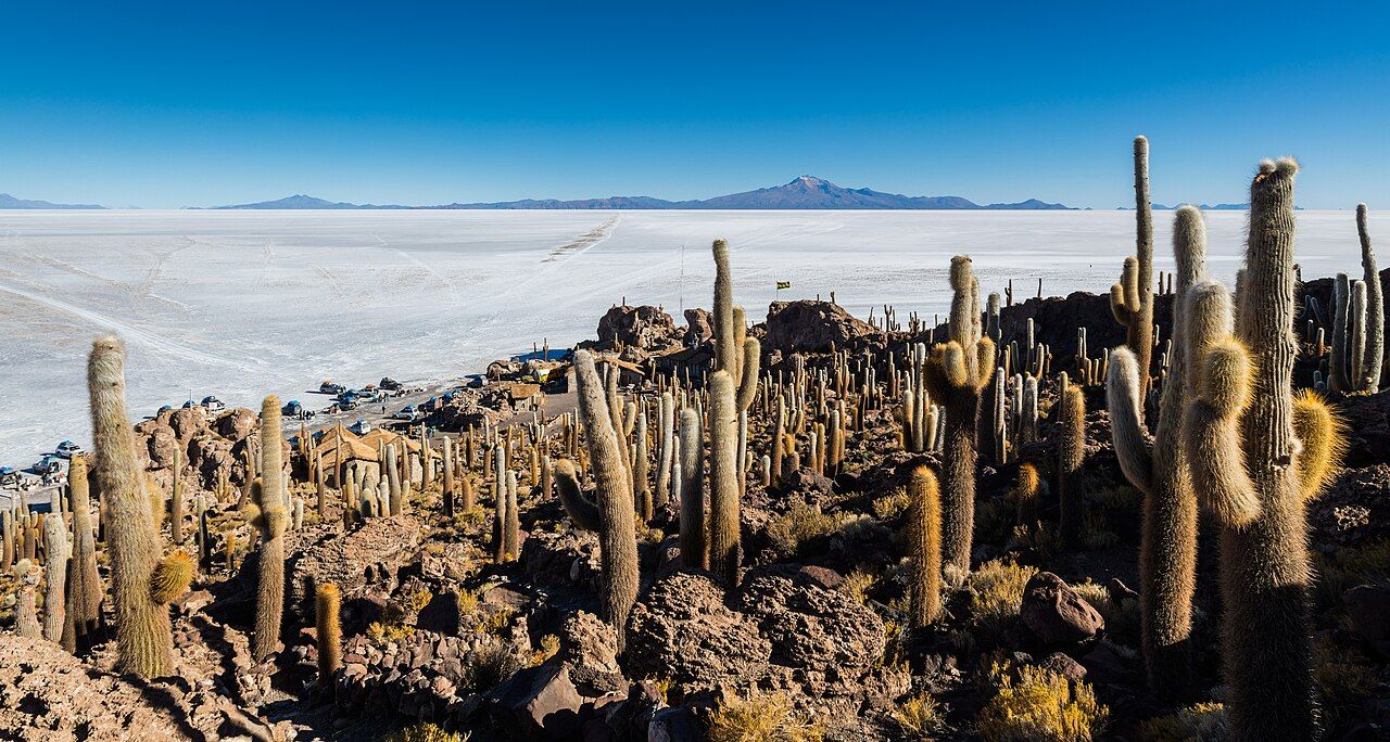
credit
Diego Delso · CC BY-SA 4.0The glare off the salt is intense even on cloudy days, so wear good sunglasses from the moment you leave town. And stay with your vehicle and your driver, since the flat is vast and there are no landmarks to walk back by.
The mirror season
The rainy season, roughly December to April, lays a thin layer of water over parts of the flat. When the water is calm and shallow and the sky clear, the salt becomes a perfect mirror, and sunrise and sunset can be extraordinary. The best mirror conditions are often from January to March, but rain, wind and water depth vary from year to year and from day to day.
Sunrise on the wet salt is the closest thing to standing in the sky.
Sunrise on the wet salt is the closest thing to standing in the sky. There are trade-offs, though. When it is very wet, vehicles cannot drive far onto the flat, so tours stay near the edges, and some routes, including the trip to Isla Incahuasi and the multi-day journey south, can be changed or cancelled. Salt water is hard on shoes and cameras; tours often provide rubber boots, but check. In the dry season, from about May to November, the flat is white and hard, every route is usually open, and the skies are often very clear, though nights are bitterly cold.
 Next on the tag · Latin AmericaGranada and Lake Nicaragua
The lagoons, flamingos and the altiplano
South of the salar, the longer tours cross a high desert of volcanoes, rock formations and lagoons coloured by minerals and algae. Much of it lies in the Eduardo Avaroa Andean Fauna National Reserve, which charges an entry fee, usually paid in cash at the gate. Laguna Colorada, a shallow lake stained red and rust by algae, is home to large numbers of flamingos: three species of flamingo live in this region, feeding in the cold, salty water. Laguna Verde lies at the foot of the cone of Licancabur volcano, on the border with Chile, and its colour changes with the wind and light.
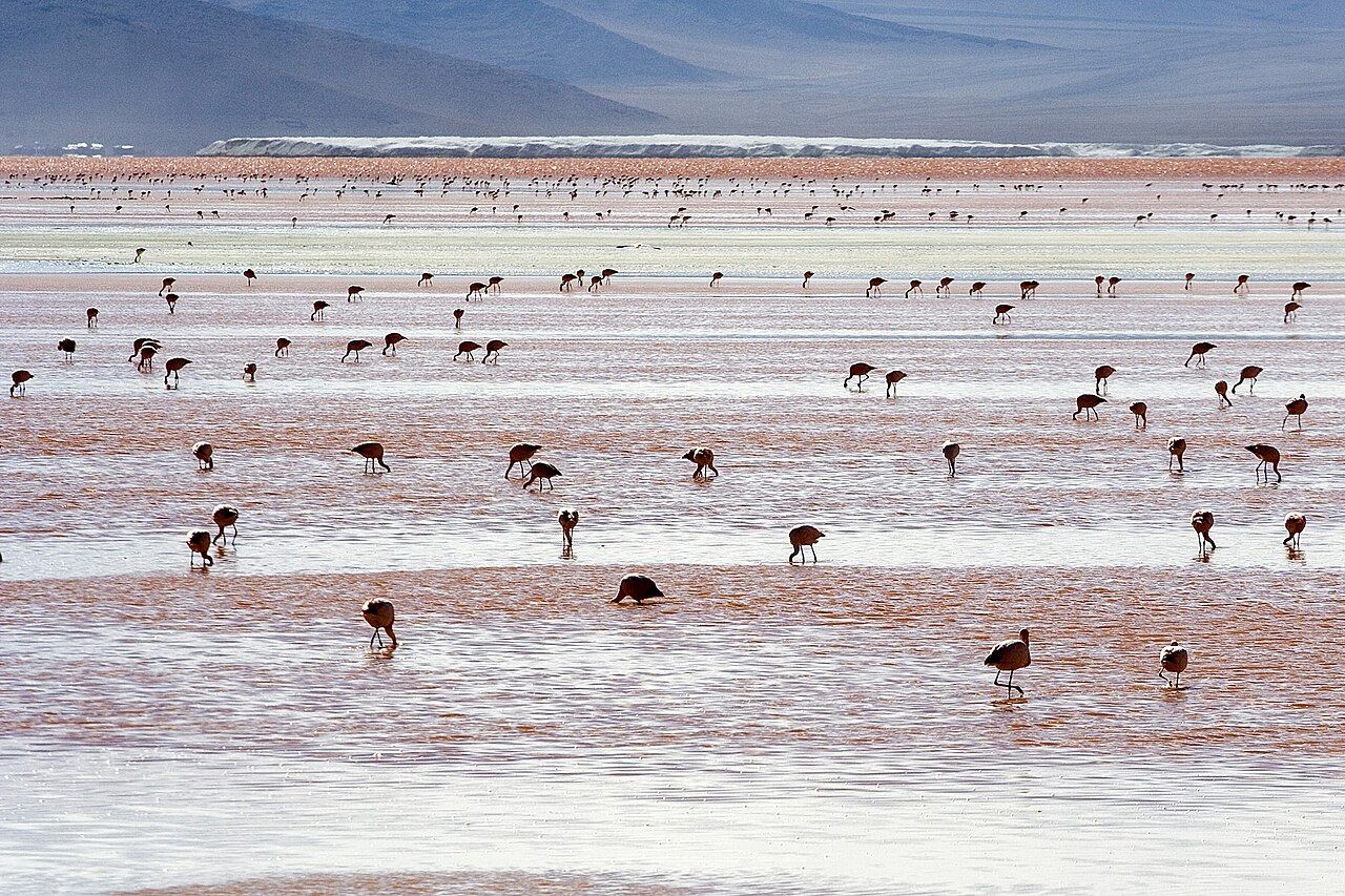
credit
Luca Galuzzi ( Lucag ) · CC BY-SA 2.5Other stops usually include a stone tree carved by wind in the desert, a field of steaming geysers and mud pots at very high altitude, best seen at dawn, and hot springs where you can soak in the early morning cold. Llamas and vicuñas graze along the way. Keep your distance from the flamingos and other wildlife, stay on the paths around the geysers, where the ground can be thin and scalding, and take all your rubbish away with you.
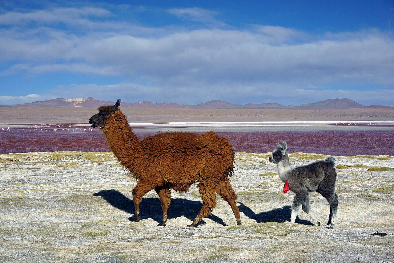
credit
kallerna · CC BY-SA 4.0Many multi-day tours end at the Chilean border, where you can cross towards San Pedro de Atacama, or return to Uyuni.
Altitude and cold nights
Nearly the whole route lies above 3,600 metres, and the geysers and highest passes approach 5,000. Altitude sickness is common, and it can affect fit young people as easily as anyone. Spend a few days at altitude before the tour, in La Paz, Sucre or Potosí, drink plenty of water, go easy on alcohol, and talk to a doctor before you travel about prevention and medication. Coca tea is widely drunk in the region. If symptoms become severe, going down is the treatment, which on the altiplano is not always quick, so tell your driver early if you feel unwell.
Nights are cold all year and well below freezing in the dry season, and lodgings on the route are basic, with little or no heating and sometimes limited hot water or electricity. Bring a warm sleeping bag or check the one provided, a down jacket, hat, gloves and thermal layers. Days are bright and the sun is fierce at this height: good sunglasses, a sunhat and strong sunscreen are essential, and lip balm helps in the dry air.
If you are arriving from a long flight, read the notes on your first days after arriving, and do not come straight up from sea level to the salar.
Choosing a responsible tour
Dozens of agencies in Uyuni sell tours that look identical on paper. They are not. Serious accidents have happened on these routes, often involving speeding, tired or drinking drivers, or poorly maintained vehicles. Price is a poor guide on its own.
Before you pay, ask how many people will share the vehicle, whether every seat has a working seat belt, whether there are spare tyres and basic tools, what emergency equipment and communication the driver carries, and how much driving experience the driver has on this route. Look at recent reviews from other travellers, and talk to people just back from a tour. If the answers are vague, or the agency pressures you to decide on the spot, walk away.
On the road, it is reasonable to ask the driver to slow down, and to refuse to continue if you believe they have been drinking. Keep valuables in a small bag with you, and keep a copy of your documents separately, since bags travel on the roof; the advice on the bag that did not arrive applies here too. Uyuni is reached by flights and overnight buses from La Paz and by trains from Oruro. If your route through South America continues north, the green hills of Colombia's coffee country could hardly be more different, and the guide to eating vegetarian on the road has phrases for the whole trip.